- 2025-05-09 15:26 8694
- 产品价格:面议
- 发货地址:北京海淀 包装说明:不限
- 产品数量:9999.00 套产品规格:不限
- 信息编号:234829888公司编号:14832749
- 王经理 微信 18510103847
- 进入店铺 在线留言 QQ咨询 在线询价
诚信代理_gs正版软件介绍
- 相关产品:
科学软件网专注提供科研软件。截止目前,共代理千余款,软件涵盖各个学科。除了软件,科学软件网还提供课程,包含34款软件,66门课程。热门软件有:spss,stata,gams,sas,minitab,matlab,mathematica,lingo,hydrus,gms,pscad,mplus,tableau,eviews,nvivo,gtap,sequncher,simca等等。
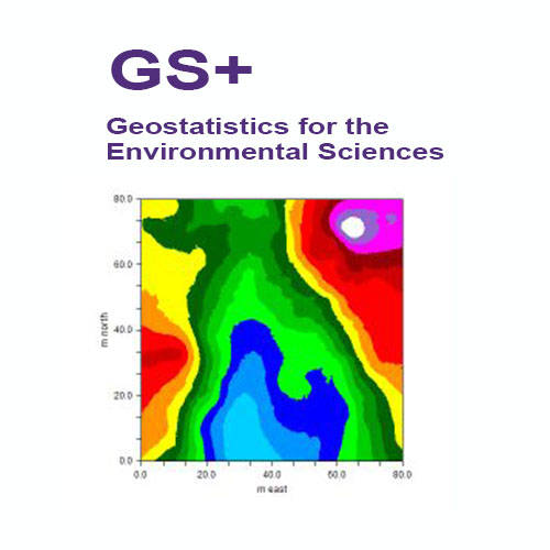
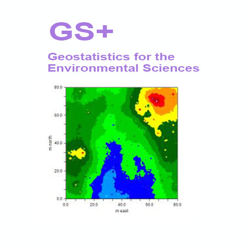
An Interpolation Grid in GS+ allows the interpolation boundaries (whether kriging, conditional simulation, or IDW) to be defined and sets the intensity (grid spacing) at which the interpolation will occur.
GS+ 环境科学地质统计学软件
概述
GS+软件于1988年作为个针对个人电脑和工作站的综合地理统计程序被引入。它很快成为全球用户使用的地理统计程序。广受好评的是,GS+是个通过集成包提供半方差分析的地理统计软件,它提供了所要求的灵活性和新手所欣赏的简单性。GS+支持从Windows 7到10的操作系统。
今天GS+仍然是地球和环境科学的的2D地理统计软件。它在世界范围内被工业、机构和学术研究人员使用。GS+已被用于数百项空间分析的科学研究。而那些通过ESRI和其他GIS供应商提供GIS软件包的用户更喜欢GS+,因为它可以更全面地访问复杂的分析。输出的文件,可以很容易地将导入到GIS数据库和地图中。
快速执行地理统计分析
地理统计学提供了一种方法,可以更好地理解空间数据中固有的自相关,并定义和使用这种变化,以便更好地估计未被采样的地方的值,从而创建优、无偏离的地图。GS+提供了对这些计算密集型分析的简单访问。无论您是在分析石油沉积物、浮游生物分布、太阳黑子模式、性疾病爆发或土壤资源,GS+都能让您随时掌握地质统计学的功能。
Create interpolation output files that are usable by many other programs
GS+ creates interpolation output files (from kriging, cokriging, simulation, or inverse distance techniques) that can be read into many other types of mapping programs. GS+ will use these files to create it’s own maps or you can read the data into any GIS or mapping program that supports ArcInfo® or Surfer® input formats.
Cross-validation allows you to test your interpolation system against sampled data
In cross-validation analysis each measured point in a spatial domain is individually removed from the domain and its value estimated via kriging or inverse distance weighting as though it were never there. In this way a graph of estimated vs. actual values for each sample location in the domain can be constructed and used to test the interpolation system.
GS Geostatistics Software
GS is a comprehensive geostatistics software program that is fast, efficient, and easy to use. GS provides all geostatistics components, from semivariance analysis through kriging and mapping, in a single integrated software program widely praised for its flexibility and friendly interface. Many users are surprised that geostatistical analysis can be so easy and intuitive.
创建变异函数
GS+使您可以完全控制变差函数参数,如主动滞后距离和个体滞后类的大小。默认值提供了合理的起点,您可以优化分析以适应特定的数据集。
自动创建变差函数模型---可以自动创建kriging模型,大程度地使用迭代技术来优化您的数据,以优化良好的模型拟合。模型窗口允许您覆盖GS+选择的值,滑动条控件允许您立即看到更改的结果。GS+为几乎所有的kriging应用程序提供足够的模型。
由于数据异常,变差函数有时是不规则的---当它们是的值时,它们就会变得很明显,而不是与其他值在特定的范围内自动关联。GS+提供了h散射图和方差云分析,使您能够快速地可视化和识别异常值,并且新的掩饰命令允许您像手术一样移除(暂时或地)违规数据记录。定向变异(各向)函数是同时产生的各向同性的变量,所以您可以很容易地评估自相关是否依赖于罗盘的方向。例如,当存在一个斜率效应或其他环境特征时,在一个方向上的自相关与另一个方向的自相关是不同的。
But don't take our word for it
Take the word of the hundreds of scientists and engineers who have cited GS+ in their research publications – over 100 in 2019 alone. Or the hundreds of users at universities, government and non-governmental research institutes, and various industries in almost every country in the world.
GS+ means geostatistics
Geostatistics is not an add-on feature of GS+ – it is the heart of the software. Many of our users have access to other geostatistics tools within their favorite GIS or mapping programs, but come to GS+ for their serious geostatistical analyses. Because GS+ output is compatible with industry standards, GS+ can be used directly with many of these other programs. Or it can be used standalone – GS+ has its own data worksheet (which also accepts Excel, Access, and other types of data files) and produces its own maps.
,专注,专心是科学软件网的服务宗旨,开发的软件、传递前沿的技术、提供贴心的服务是我们用实际行动践行的至高目标,我们会为此目标而不懈努力。

