
- 2025-02-21 15:26 5094
- 产品价格:面议
- 发货地址:北京海淀 包装说明:不限
- 产品数量:9999.00 套产品规格:不限
- 信息编号:253727927公司编号:14832749
- 王经理 微信 18510103847
- 进入店铺 在线留言 QQ咨询 在线询价
surfer代理 诚信代理
- 相关产品:
北京天演融智软件有限公司(科学软件网)前身是北京世纪天演科技有限公司,成立于2001年,专注为国内高校、科研院所和以研发为主的企事业单位提供科研软件和服务的国家。
Work Seamlessly with all Coordinate Systems
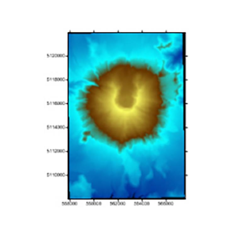
Your job is to transform data into valuable visualizations. Surfer’s job is to make it easy for you. Surfer effortlessly manages unreferenced data and data projected in different/multiple coordinate systems. It really is that easy.
Surfer Coordinate System Features
Over 2500 predefined coordinate systems
Create custom coordinate systems
Search coordinate systems by name or EPSG number
Reproject coordinate systems
Over 80 ellipsoids
Over 45 predefined linear units
Create custom linear units
Add graticule or grid lines to view different coordinate systems on a map
Supported server types:
Surfer's LAS/LAZ Filtering Options
Spatial filtering based on XY bounds or elevation data limits
Import every Nth point
Import only the desired Return type or Classification values
Import data with specified Source ID
Flag filters such as scan direction, edge of flight, or synthetic, key, and withheld points
Immediate Access to Online Data
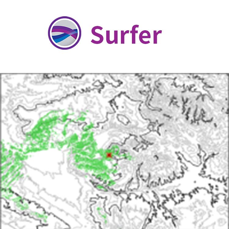
An abundance of data is at your fingertips waiting to be visualized. Surfer gives you immediate access to worldwide aerial imagery, Open Street Map imagery, worldwide vector data, and terrain data. If you have your own favorite data servers or access to a private data server, include a custom link to that source for easy access. Surfer makes it easy to access the surplus of online data.
Supported server types:
Web mapping server (WMS)
Open Street Map server (OSM)
Web coverage server (WCS)
Web feature server (WFS)
科学软件网为全国大多数高校提供过产品或服务,销售和售后团队,确保您售后无忧!


