- 2024-06-12 15:26 10594
- 产品价格:面议
- 发货地址:北京海淀 包装说明:不限
- 产品数量:9999.00 套产品规格:不限
- 信息编号:214879088公司编号:14832749
- 王经理 微信 185101038..
- 进入店铺 在线咨询 QQ咨询 在线询价
EVS Pro_放心购买_evs软件百科
- 相关产品:
科学软件网销售软件达19年,有丰富的销售经验以及客户资源,提供的产品涵盖各个学科,包括经管,仿真,地球地理,生物化学,工程科学,排版及网络管理等。此外,我们还提供很多附加服务,如:现场培训、课程、解决方案、咨询服务等。
Vector And GIS Output Formats
Output Complete Models as C Tech 4D Interactive Models (4DIM)
Output Complete Models as VRML (type 1 and 2)
Output Any Object as a 3D ESRI Shapefile or a 3D DXF File
3D Parameter Estimation Using Expert System Driven Kriging
GS
Automatic 3D Adaptive Grid Refinement
GS/G Limited
Ability to Automatically Handle Time Domain Data
Compensation for Anisotropic Media Transmissivity
Geologic Modeling
Surface Based Hierarchical Layer Models
G
Smooth Geologic Indicator Kriging
G – Size and complexity Limits
Incorporate Surficial Geology with Smooth Geologic Indicator Kriging
地质统计学功能
MVS地质统计学模块被用来估计黄金浓度使用所有可用的分析数据。所有地区的非盟级以上30磅的显示,根据地层学与矿色。
站点分析
MVS用于分析、规划和可视化的土壤修复前在加州中部天然气加工厂。
矿体和污染羽状物
MVS重要的功能之一是计算矿体或污染羽表土。使用它,您可以快速确定提取柱所需的坑。地球物理参数如坑壁坡度和挖掘精度的计算。
复杂的三维建模
MVS能够模拟复杂的地形学的关系。断层、地垒、地堑、褶皱复杂的三维模型,盐丘和其他许多复杂的地质结构使用MVS很*创建。
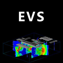
Each major release of Earth Volumetric Studio includes a corresponding release of Earth Volumetric Studio Sample Projects. Each project folder includes a number of applications which strive to introduce all major modules in Studio with real-world examples provided by our customers over our 27 year history. The video below shows the outputs from 180+ applications in the August 2016 Earth Volumetric Studio Projects. In under 10 minutes you’ll get a comprehensive overview of the breadth of projects which Studio can tackle.
科学软件网不定期举办各类公益培训和讲座,让您有更多机会免费学习和熟悉软件。
联系电话是4008104001, 主要经营北京天演融智软件有限公司(科学软件网)主营产品PSCAD, CYME, SPSSPRO, Stata, Matlab,GAMS,Hydrus,GMS,Visual Modflow 等各学科软件,科学软件网有20多年的软件销售经验,提供专业销售和培训服务,还有更多的增值服务。目前,科学软件网提供的软件有数百种,软件涵盖的领域包括,经管,仿真,地球地理,生物化学,工程科学,排版及网络管理等各个学科。。
单位注册资金单位注册资金人民币 1000 - 5000 万元。
