
- 2025-03-03 15:26 22994
- 产品价格:面议
- 发货地址:北京海淀 包装说明:不限
- 产品数量:9999.00 套产品规格:不限
- 信息编号:220097984公司编号:14832749
- 王经理 微信 18510103847
- 进入店铺 在线留言 QQ咨询 在线询价
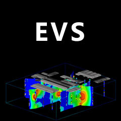
EVS Pro_正规代理_evs正版软件怎样用
- 相关产品:
科学软件网提供的软件覆盖各个学科,软件数量达1000余款,满足各高校和企事业单位的科研需求。此外,科学软件网还提供软件培训和研讨会服务,目前视频课程达68门,涵盖34款软件。
Environmental Visualization System (EVS Pro)是用于性分析,可视化和动画的早的产品。它包括网格模块,建模工具,输出选项,地质统计分析、 动画分析、GIS功能等。更多的功能还包括动画输出、实时地形漫游、地质结构建模、交互式分析、4DIM & VRML II 输出;ODBC数据库链接等。
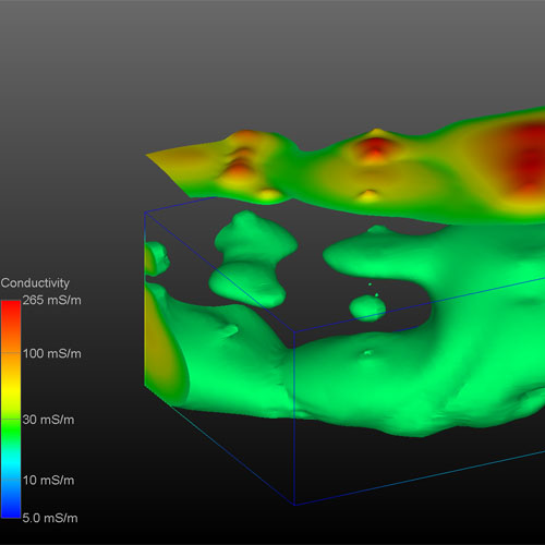
EVS Pro的渲染提供了显著、完整的三维可视化技术以对污染的状况进行充分分析和可视化。
C Tech’s Earth Volumetric Studio is the world’s leading three-dimensional volumetric Earth Science software system developed to address the needs of all Earth science disciplines. Studio is the culmination of C Tech’s 29 years of 3D modeling development, building upon the developments of EVS-Pro, MVS and EnterVol. Studio’s customizable toolkit is targeted at geologists, environmental engineers, geochemists, geophysicists, mining engineers, civil engineers and oceanic scientists. Whether your project is a corner gas station with leaking underground fuel tanks, a geophysics survey of a large earthen dam, combining 3D resistivity and magnetics data, or modeling of salt domes and solution mined caverns for the U.S. Strategic Petroleum Reserves, C Tech’s Earth Volumetric Studio has the speed and functionality to address your most challenging tasks. Our software is used by organizations worldwide to analyze all types of analyte and geophysical data in any environment (e.g. soil, groundwater, surface water, air, etc.).
Compute Isolines displayed on the surface of a model which accurately follow the data at a sub-feature level.
3D Volumetric Plumes representing a 3D subset of your model based on any attribute. All data within the volumetric model will be retained in the volumetric subset.
Isosurfaces are 3D surfaces that represent a constant value within a 3D volume. These surfaces can represent a depth below ground surface, a constant concentration within a volume or any other 2D subset of the volume. All data within the volumetric model will be mapped to the surface.
Earth Volumetric Studio (Studio)是Environmental Visualization System和Mining Visualization System,结合多年EnterVol开发的一个革命性的集成软件。Earth Volumetric Studio在更新的,友好的用户环境中保留了之前版本的模块化工具包范例。Earth Volumetric Studio是一个立的Windows程序,它可以提供的运行速度、功能和灵活性。Studio了的体积网格,地球统计分析和4D可视化工具,应用于所有地球科学学科。图形用户界面集成了模块化分析和图形例程,可以定制和组合,以满足任何应用程序的分析和可视化需求。Studio可以用来分析任何环境中所有类型的分析和地球物理数据。(如土壤、地下水、地表水、空气、噪音、
电阻率等)。Earth Volumetric Studio的综合地质统计学提供了对数据和站点模型质量的定量评估,并确定需要额外数据收集的位置。
Earth Volumetric Studio将以前开发的Environmental Visualization System Pro和MVS (Mining Visualization System)的功能都囊括在了一个功能更强大操作更简单的环境之中。功能包括:钻孔和样本发布;参数估计使用佳拟合函数的系统驱动的2D和3D Kriging算法;爆裂地质层;有限差分网格生成的有限元建模;网格;拥有几乎所有功能的Python脚本;高水平动画支持;交互式3D栅栏图;多分析物的数据分析和综合容积和质量计算土壤及地下水污染和矿体。还有一些以前我们从MVS软件中了解到的,满足矿业、规划师,或地质学家和环境们苛刻的要求。这些功能包括:3D断块迭代;隧道挖掘;纹理映射;矿井建模;矿体覆盖的可视化与建模以及其他附加的功能。
Rendered Output Formats
OpenGL Rendered Bitmpas at Screen Resolutions
ArcGIS
High Resolution Rendered Bitmap Images (all formats)
ArcGIS
High Resolution Georeferenced BMP and World Files
ArcGIS
Animation Output as AVI, MPEG, and HAV (lossless)
科学软件网不定期举办各类公益培训和讲座,让您有更多机会免费学习和熟悉软件。


